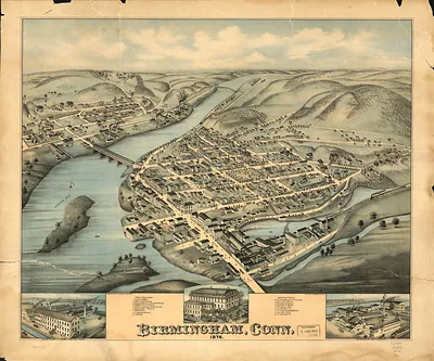
New Haven, Connecticut, 1879 – Antique Wall Map

(Originally scanned by the Library of Congress. Each image is professionally and digitally cleaned of artifacts such as color bars and extra borders prior to printing.)
Description
Few images capture their era like this antique map of New Haven, Connecticut, 1879. Sourced directly from the Library of Congress, it represents an authentic piece of documented history.
Library of Congress record: The city of New Haven, Conn. 1879
Framed, it is ready for the wall; unframed, it is ready for the frame you choose. It makes a striking addition to a living room, study or office, and a thoughtful gift. Free shipping in the lower 48 states. Snapshots of the Past, founded in 2001, has served tens of thousands of customers worldwide.
New Haven, Connecticut, 1879
Order a print
Thank you. Your order went through, and a receipt is on its way by email.
Secure checkout · SSL encryptedPowered by Stripe and PayPal
Free shipping in the lower 48 states. The checkout page shows the picture, size and price before you pay.
New Haven, Connecticut, in 1879 was a busy harbor and manufacturing city of roughly 50,000 people, sitting on Long Island Sound and tied together by several rail lines. Its economy rested on a mix of industry: the Winchester Repeating Arms Company and the Sargent hardware works turned out firearms and locks, while carriage makers, clockmakers, and piano and organ builders kept the city's shops and factories running. Yale College, founded in the early 1700s, dominated the city's civic and social life, and the green at its center was the heart of the town. Residents would have known New Haven as both a port for coastal shipping and a college town, a combination that gave it a distinctive character among Connecticut's cities.
| Created / published | 1879 |
|---|---|
| Creator | bailey, o. h. (oakley hoopes), hazen, j. c. |
| Notes | Bird's-eye view map. |
| Subjects | Panoramic maps--Connecticut |
| Source | Library of Congress, Panoramic Maps |
| Original scan | 11,722 × 9,088 px · prints to 39 × 30 in at 300 dpi |
| Library of Congress title | The city of New Haven, Conn. 1879 |
| Reference | CT-NewHaven-1879 |
More from the Panoramic Maps collection
Snapshots of the Past helps heritage brands, museums, historians and storytellers tell stories with history: historic prints, image licensing and historical storytelling drawn from more than 25 years of research and curation.