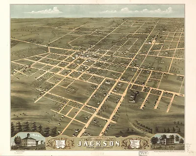
Chattanooga, Tennessee, 1887 – Historic Map Reproduction

(Originally scanned by the Library of Congress. Each image is professionally and digitally cleaned of artifacts such as color bars and extra borders prior to printing.)
Description
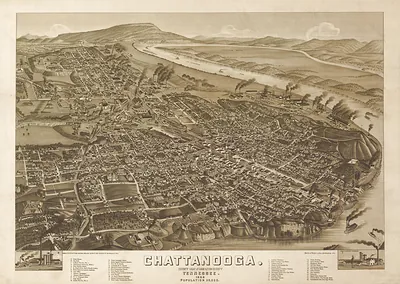
Few images capture their era like this antique map of Chattanooga, Tennessee, 1887. It comes from the collections of the Library of Congress, scanned from the original and carefully restored.
Library of Congress record: Chattanooga, Tenn. as seen from Bragg Hill, Missionary Ridge
The framed print arrives ready to hang; the unframed option suits custom framing. It brings character to any room and makes a memorable gift. Free shipping in the lower 48 states. Snapshots of the Past has been bringing history to the wall since 2001, for tens of thousands of customers worldwide.
Chattanooga, Tennessee, 1887
Order a print
Thank you. Your order went through, and a receipt is on its way by email.
Secure checkout · SSL encryptedPowered by Stripe and PayPal
Free shipping in the lower 48 states. The checkout page shows the picture, size and price before you pay.
In 1887 Chattanooga was laid out between the Tennessee River bend and the long ridges of Lookout Mountain and Missionary Ridge, and the town's street grid pressed right up against both. The Chattanooga National Cemetery on Orchard Knob, where Union dead from the surrounding battlefields had been gathered after 1867, drew visitors and veterans to the town's edge. Hotels and summit views on Lookout Mountain were already attracting tourists from the North and South, so the view of the ridges was becoming a selling point as well as a memory. Residents living under those heights knew their city as a place where the war's geography and a newer commercial life stood side by side.
| Created / published | 1887 |
|---|---|
| Creator | anderson, j. c. (john c.) |
| Notes | Bird's-eye view map. |
| Subjects | Panoramic maps--Tennessee |
| Source | Library of Congress, Panoramic Maps |
| Original scan | 8,016 × 5,928 px · prints to 27 × 20 in at 300 dpi |
| Library of Congress title | Chattanooga, Tenn. as seen from Bragg Hill, Missionary Ridge |
| Reference | TN-Chattanooga-1887 |
More from the Panoramic Maps collection
Snapshots of the Past helps heritage brands, museums, historians and storytellers tell stories with history: historic prints, image licensing and historical storytelling drawn from more than 25 years of research and curation.