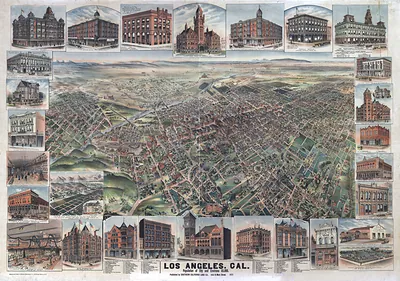
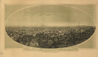
Los Angeles, California, 1877 – Antique Wall Map

(Originally scanned by the Library of Congress. Each image is professionally and digitally cleaned of artifacts such as color bars and extra borders prior to printing.)
Description
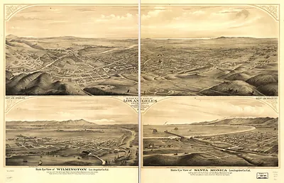
A window into the past: Los Angeles, California, 1877, preserved in this antique map. An authentic image from the Library of Congress, it carries the weight of the real historical record.
Library of Congress record: View of Los Angeles from the east. Brooklyn Hights in the foreground; Pacific Ocean and Santa Monica Mountains in the background
The framed print arrives ready to hang; the unframed option suits custom framing. A conversation-starting piece for home, office, or as a meaningful gift. Free shipping in the lower 48 states. Snapshots of the Past has been bringing history to the wall since 2001, for tens of thousands of customers worldwide.
Los Angeles, California, 1877
Order a print
Thank you. Your order went through, and a receipt is on its way by email.
Secure checkout · SSL encryptedPowered by Stripe and PayPal
Free shipping in the lower 48 states. The checkout page shows the picture, size and price before you pay.
Los Angeles in 1877 was still watered largely by the Zanja Madre, a ditch dug in the Spanish period that carried river water through the town's streets to households, gardens and fields. Its residents depended on that system as much as on the new rail lines, since the city had few wells and the river ran unreliably. Cattle and sheep ranching on the big grants south and east of town still supplied meat and wool, and the Plaza remained the civic center, where merchants, county officials and Spanish-speaking families crossed paths daily. Many people in the city also watched the nearby coast, where the town's shipping still moved through the landing at Wilmington rather than a deep-water port.
| Created / published | 1877 |
|---|---|
| Creator | a.l. bancroft & company, brooklyn land and building co, glover, e. s. (eli sheldon) |
| Notes | Bird's-eye view map. |
| Subjects | Panoramic maps--California |
| Source | Library of Congress, Panoramic Maps |
| Original scan | 8,208 × 4,272 px · prints to 27 × 14 in at 300 dpi |
| Library of Congress title | View of Los Angeles from the east. Brooklyn Hights in the foreground; Pacific Ocean and Santa Monica Mountains in the background |
| Reference | CA-LosAngeles-1877b |
More from the Panoramic Maps collection
Snapshots of the Past helps heritage brands, museums, historians and storytellers tell stories with history: historic prints, image licensing and historical storytelling drawn from more than 25 years of research and curation.