Washington 1852 uncorrected, Washington DC – Vintage Map Wall Art

(Originally scanned by the Library of Congress. Each image is professionally and digitally cleaned of artifacts such as color bars and extra borders prior to printing.)
Description
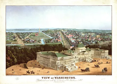
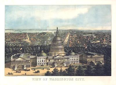
Step back in time with Washington 1852 uncorrected, Washington DC, an antique map rich in period detail. The original is held by the Library of Congress, so what you hang is a true record of its time.
Library of Congress record: View of Washington
Framed, it is ready for the wall; unframed, it is ready for the frame you choose. Perfect for a home, office, library or classroom wall, and a gift with a story behind it. Free shipping in the lower 48 states. Since 2001, Snapshots of the Past has shipped historic prints to tens of thousands of customers around the world.
Washington 1852 uncorrected, Washington DC
Order a print
Thank you. Your order went through, and a receipt is on its way by email.
Secure checkout · SSL encryptedPowered by Stripe and PayPal
Free shipping in the lower 48 states. The checkout page shows the picture, size and price before you pay.
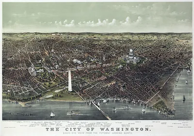
In 1852, Washington City was a government town of roughly 40,000 people, shaped more by federal offices than by factories. The Capitol was still being enlarged, with new wings under construction, and the Washington Monument stood unfinished at the edge of the Mall after work began in 1848. Trade moved along the Chesapeake and Ohio Canal, which had reached Cumberland in 1850, and along the Baltimore and Ohio Railroad, which linked the capital to Baltimore and the North. Residents lived with the contradictions of a slaveholding Southern city on the national seat of government, and the 1850 compromise had recently ended the sale of enslaved people in the District. This bird's-eye view captures a city whose wide avenues were laid out for a larger future than the one it had yet achieved.
| Created / published | 1852 |
|---|---|
| Creator | e. sachse & co |
| Notes | Bird's-eye view map. |
| Subjects | Panoramic maps--Washington DC |
| Source | Library of Congress, Panoramic Maps |
| Original scan | 9,136 × 6,528 px · prints to 30 × 22 in at 300 dpi |
| Library of Congress title | View of Washington |
| Reference | DC-Washington-1852-uncorrected |
More from the Panoramic Maps collection
Snapshots of the Past helps heritage brands, museums, historians and storytellers tell stories with history: historic prints, image licensing and historical storytelling drawn from more than 25 years of research and curation.